Capping Energy Wells
Quoits
Quoits (cromlechs or dolmens) were built in the mid-3000s BCE, around the same time as the tor enclosures. They're surprisingly advanced structures that involved careful quarrying, engineering and transport of stones.
Normally they're looked on as tombs, but I suggest they were energy-chambers sitting on top of underground blind springs, built for capping up-welling energy-vortices from below, or for capturing an energy-line in the landscape, terminating it there and sending it downwards. High-energy fields could be generated within the chamber - and that was one of their main purposes.
They will have been used as repositories for storing and charging up objects, tinctures and special items, as initiatory and healing chambers, and also for funerary rites but not for actual burial.

Chûn Quoit

Chûn Quoit with Carn Eanes and Boscaswell church behind. In this photo Chûn Castle is behind us
Chûn Quoit, 5,500 years old, is the only intact quoit. From here you can see the winter solstice sunset over Carn Kenidjack, a mile away. The quoit sat downhill from a Neolithic enclosure on Chûn Castle. When both were built, the land around them would have been forested.

Looking inside Chûn Quoit. Most archaeologists believe that quoits were covered with earth (as if a burial chamber) but those gaps are too large to keep the earth out. No, quoits were not for burial and I don't think they were covered - and no quoits around here show convincing signs of being earth-covered. It's a case of fitting the evidence around the theory, but the theory is, well, rather empty

Chûn Quoit as seen from Boswens menhir, about half a mile away (telephoto shot). Chûn Quoit is clearly highlighted on the horizon from Boswens, but not vice versa
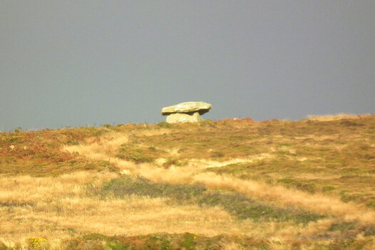
Chûn Quoit from down in the Gump
Mulfra Quoit is not quite intact. One vertical stone (orthostat) is removed, with the capstone propped on the side, as if intentionally decommissioned. It has a fine view of St Michael's Mount, toward the winter solstice sunrise.

Mulfra Quoit with St Michael's Mount and Cudden Point behind (both cliff sanctuaries and all three are neolithic sites)

Mulfra Quoit. I think it was decommissioned - notice how the capstone is carefully laid on the side. Also one vertical propping stone has been taken away completely
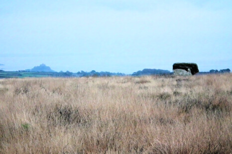
Mulfra Quoit and St Michael's Mount as seen from Beacon Barrows

Mulfra Quoit's former capstone, broken in one corner
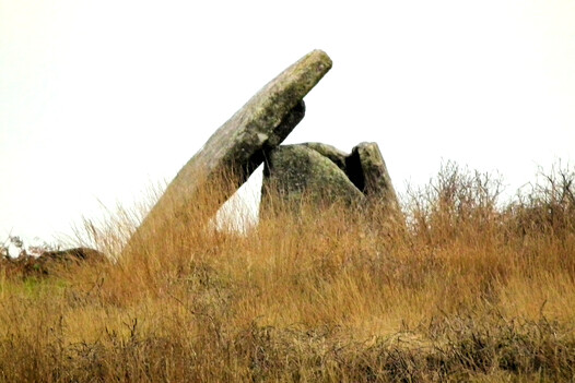
Mulfra Quoit
Zennor Quoit is possibly 'de-commissioned', its capstone set to the side. Nearly destroyed by a farmer, it was saved by an antiquarian. An alignment from Sperris Quoit to Zennor Quoit aligns with Lanyon Quoit and the lunar max rising point.

Zennor Quoit. The low vertical stone on the right of the picture is not part of the original quoit
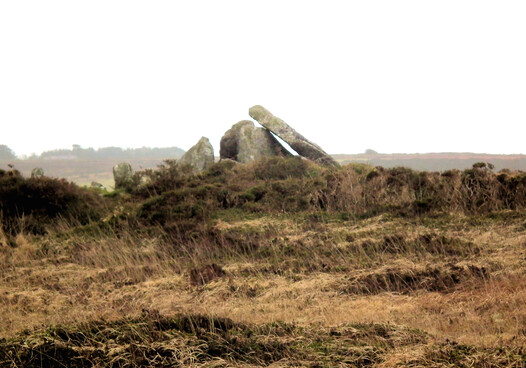
Zennor Quoit. This quoit was possibly decommissioned too

Zennor Quoit, looking ethereal

Zennor Quoit, looking rather dishevelled in this photo

Zennor Quoit, looking mystical
Sperris Quoit (below) is very damaged. It's not far from Zennor Quoit and a little tricky to find, but worth it. A few of its stones remain. Around it is a rock temple of granite rocks, with propped and placed stones.
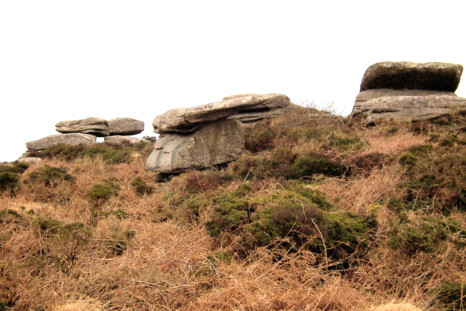
Placed stones and a rock temple at Sperris Quoit. This 'temple' might have been gardened too - certainly the climate was warmer and better, and these hills were green and pleasant then, and a good place to live. Neolithic des res.

Zennor Quoit as seen from Sperris Quoit. If you continue over the far horizon in a straight line, you'll reach Lanyon Quoit

The sad remains of Sperris Quoit, which might have been quite grand in its heyday. Like most of the quoits it was built around 3700-3500 BCE.

Lanyon Quoit
Lanyon Quoit fell down in a storm in the 19th C and was incorrectly restored, with some stones missing. But it's at the right location, in sight of Carn Galva, the Neolithic tor. Around it is a complex with a long cairn, a cist cairn, stones and pools.
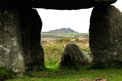
Lanyon Quoit with neolithic tor Carn Galva behind. Both were part of the same wide sacred landscape

Lanyon Quoit as seen from Bosiliack Barrow (half mile telephoto shot)
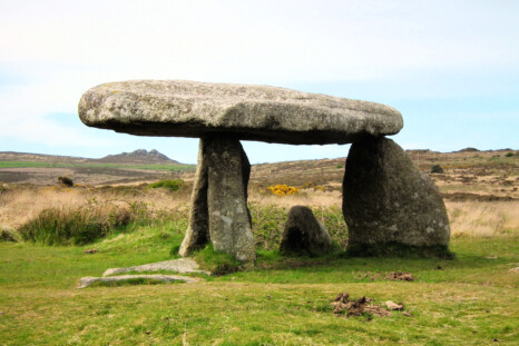
Lanyon Quoit with Carn Galva behind. As you can see from this, Lanyon Quoit was reconstructed strangely, and it has lost some of its vertical stones

Lanyon Quoit
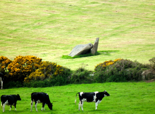
The sad remains of West Lanyon Quoit, wrecked
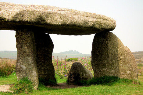
Lanyon Quoit and Carn Galva
The high Neolithic, when the quoits and tor enclosures were built, came to an end around 3200 BCE, ended by a crisis. No more megalithic structures are known to have been built in Penwith after that, until the Bronze Age came along around 2500. Strange, that.

Online maps: Quoits and Quoit Alignments or Map of the Ancient Sites of West Penwith
Quoits were not just local tribes' shrines. All located in the northern, upland part of Penwith, where most people then lived, the quoits are all positioned to reflect astronomical factors and ancient site alignments. They were built as an integrated system, and this required organisation and collaboration. Perhaps they were all built around the same time, within a generation or two.
They were a trial run in creating an integrated landscape system, a precursor to what emerged in the Bronze Age. Such a system was made up of a collection of megalithic sites that work together as one.
For more about quoits: Ancient Penwith's Quoits