Liminal Headlands
Cliff Sanctuaries
Cliff sanctuaries (cliff castles) are not normally thought of as major ancient sites. But actually they are really important.
The major ancient sites in West Penwith are located according to a geomantic system which is based upon the cliff sanctuaries. These sites, normally dated to the Iron Age, actually go much further back to the Neolithic 3000s BCE.
They're remarkable places, suffused with a power, atmosphere and mystique that is worth experiencing. One summer, make it a project to visit them. (Take a picnic.)

Treryn Dinas

Carn Lês Boel, a cliff sanctuary near Land's End
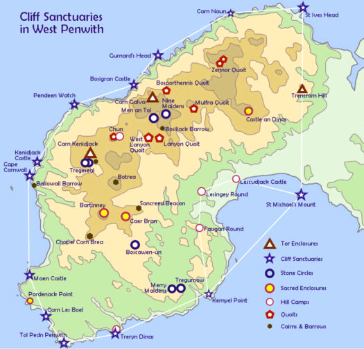
Map of the cliff sanctuaries of West Penwith
Cliff sanctuaries are roughly evenly spread around Penwith. Many are prominent headlands like Pendeen Watch or Cape Cornwall, but some are less prominent yet thy were consecrated as special cliff sites owing to their geomantic position - such as Maen Castle.
Archaeologists date cliff sanctuaries to the Iron Age because of 'defensive ramparts' built across their necks, seeing them as defensive sites. But many are not defensible, and this was not their primary purpose. They were power places for gatherings, rites, retreats and a variety of purposes. I call these type one cliff sanctuaries.
Type two have a high platform suitable for gatherings with an outcrop carn below, jutting into the sea. Examples: Tol Pedn Penwith (with Hella Point), Kemyel Point (with Carn Du) and Cudden Point.
There's a type three too, such as Cape Cornwall, Pendeen Watch and St Ives Head - distinguished by their power and presence.
Cornwall has around 40 cliff sanctuaries. Major Bronze Age sites are aligned with them. They determine the shape of the megalithic system of Penwith.
Here, cliff sanctuaries get an upgrade as major sites. Without recognising their importance, Penwith cannot be seen as one big cliff sanctuary.
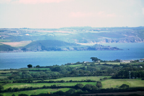
Cudden Point in Mount's Bay - a good example of a type two cliff sanctuary
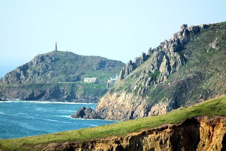
Kilgooth Ust or Cape Cornwall, as seen from the Boscregan cairns
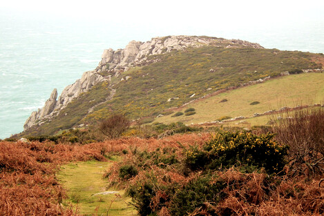
Bosigran Castle on the north coast, just below Carn Galva
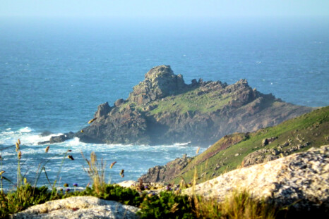
Gurnard's Head ('the desolate one')

St Ives Head, or 'The Island'

Kilgooth Ust or Cape Cornwall, as seen from the Nancherrow valley
Maen Castle is not the biggest headland in the area, yet it is a cliff sanctuary because it is aligned with St Michael's Mount and Samson Hill on Bryher, with Boscawen-ûn and eight other sites too. Maen Castle was a cliff sanctuary for its alignments, not its prominence as a headland. Nearby Mayon Cliff is not a cliff sanctuary yet it is higher.
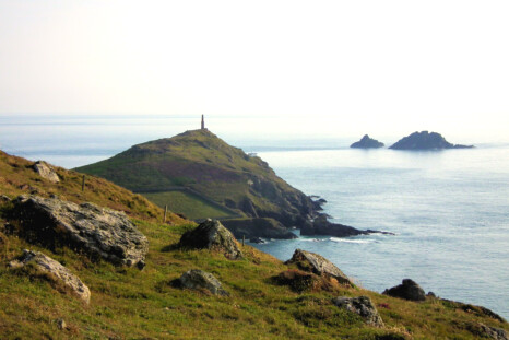
Kilgooth Ust or Cape Cornwall, with the Brisons Rocks offshore

Maen Castle, just south of Sennen
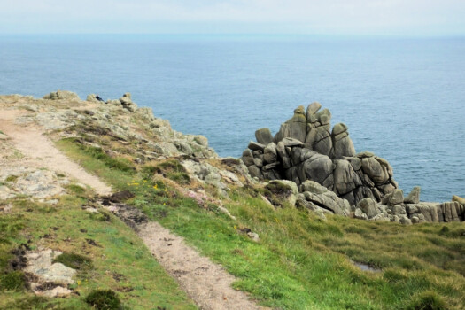
Hella Point at Tol Pedn Penwith, a type two cliff sanctuary
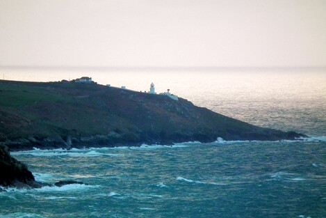
Pendeen Watch

Cape Kenidjack

Pendeen Watch as seen from Carn Eanes

Gurnard's Head

Carn Lês Boel - behind it Carn Barra and Carn Guthensbras. The gash in the side of Carn Lês Boel is a collapsed cavern - there are seal caves under the carn. It is thought that, in neolithic and bronze age times at least, this cavern was intact and it collapsed sometime in the iron age or medieval period

Map of alignments between cliff sanctuaries in West Penwith
If you look closely at the map above you'll see how many of the major ancient sites of West Penwith are located in relationship to the cliff sanctuaries and Neolithic tors. Look at Boscawen-ûn, Botrea Barrows and Lanyon Quoit. There's something remarkable about their placing and centrality.
Boscawen-ûn is located exactly between the SW and NE corners of Penwith, between Tol Pedn and St Ives Head; between Cape Cornwall and Kemyel Point (a midwinter sunrise alignment); and between St Michael's Mount and Maen Castle. Boscawen-ûn was placed there for distinctly intentional, geomantic reasons.
Stone circles and many other sites are placed in alignment with cliff sanctuaries and Neolithic tors, which give a natural, geological structure to the Penwith geomantic system.
Some alignments are natural: check out St Michael's Mount, Trencrom Hill and St Ives Head, or Cape Cornwall, Carn Galva and St Ives Head. Or look at the near right-angled triangle linking St Michael's Mount, Cape Cornwall and St Ives Head.
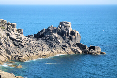
Carn Du, off Kemyel Point, Lamorna
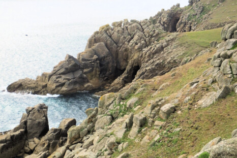
Tol Pedn Penwith, a type two cliff sanctuary

Pordenack Point, most likely not a cliff sanctuary, though it has a rare circular bronze age enclosure on top. But it could be a possible type three cliff sanctuary

Treryn Dinas
To find these sites on a detailed online map, click here: Map of the Ancient Sites of West Penwith
It's well worth visiting the cliff sanctuaries - they're special places, each with their own atmosphere. Choose a nice day and take a picnic. They're special not only because they are impressive headlands with wide seascapes but also because they were much-valued assets in former millennia, and you can feel it. Get a sense of the people who visited and occupied them, what they did and what their lives were like. The cliff sanctuaries 'held' West Penwith, acting as the basis (with neolithic tors) of the whole megalithic system in this rather super-charged peninsula.
For more about cliff sanctuaries: Ancient Penwith's Cliff Sanctuaries